
Mares’ tales and mackerel scales make tall ships take in their sails.
This is an old saying which goes back to early seafaring literature and as we were sailing to Ile des Pins yesterday we were reminded of it. The photo above was taken on our passage.
The mackerel sky is composed of billows or waves of cirrocumulus clouds which resemble scale patterns on a mackerel’s back. Mares’ tales are the streaks from cirrus clouds (see below).
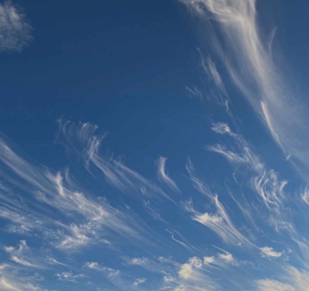
The appearance of both types of clouds together signal the approach of a warm front or Low. We would see blue skies with a leading edge of cirrus clouds which thicken into cirrocumulus. As the latter descend they turn into stratus, lower flat clouds.
The waves and tails indicate strong winds aloft and it might indicate that a strong system could be felt on the surface. As it turned out, we lost the sunshine today and have just low stratus clouds. The wind veered from South to Southwest but remained around 10 knots.
It can be said that old sayings are just partial truth, and that one remembers the hits rather than the misses. Though on this occasion, the cloud formation did announce a change from bright sunshine to total cloud cover the following day.
In researching a little about cirrus clouds, I came across an article from NASA where currently research is being conducted into the messages these high-altitude clouds can share.
The scientists involved in this research (Tristan L’Ecuyer and Graeme Stevens) study how much heat the planet holds or sends back into space and the contribution that cloud formations make. Thick low clouds like cumulus reflect sunlight whereas high thin clouds like cirrus trap the sun’s heat into the Earth’s atmosphere, they state.
They describe how cirrus clouds stream out of the chimneys of cyclones or form at the top of boiling thunderstorms and that they can stretch over entire continents. They are made up of tiny thin ice crystals which give them the ability to allow the solar rays to come into the atmosphere and prevent them from reflecting out into space.
So, they trap the heat and act like a lid. They also prevent the formation of storms in that they reduce the cycling of air so that storms and the associated rain or snow cannot happen. If, however, there is a cloud below the cirrus cloud the ability to trap heat is reduced.
With a warming planet it became increasingly important to understand the contribution that clouds are making to a warming climate. It encouraged the scientists to use satellite technology to map the clouds over the whole of the planet and to use these data to build computerized cloud models.
They found out that the higher and thinner the cirrus cloud is the more heat it traps. Astonishingly, in an interview L’Ecuyer stated that the warming effect of cirrus is six times larger than you would get by doubling all the carbon dioxide in the atmosphere.
Nevertheless, when the effect of the lower clouds is factored in, a cooling effect is felt overall in today’s climate.
Their discoveries have led to asking other important questions such as to how dust, pollution, aerosols and other particles affect this balance.
I have written previously about the large number of electric storms when we sailed through the Singapore Straits. Studies into these have revealed that the pollution caused by the many cargo ships causes this phenomenon, so I can understand how small particles from exhaust gases affect our climate and create these dangerous electric storms.

For the time being it remains to be seen in what way clouds will change in a warmer climate and whether the old sayings will continue to be remembered.
